
island - sommer 2012
|
island - sommer 2012 |
|
dienstag, 24-juli-2012: svinafell, IS - höfn, IS |
tagebuch |
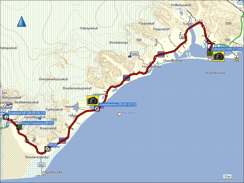
fahrt von svinafell nach höfn (139 km / 143 km).
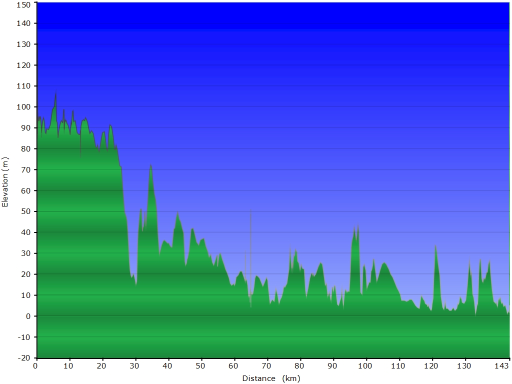
höhenprofil der fahrt von svinafell nach höfn.
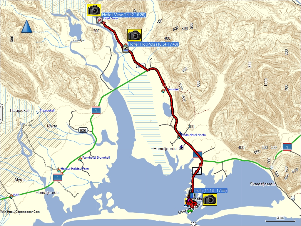
fahrt von höfn zum hoffell viewpoint und zurück (56 km / 58 km).
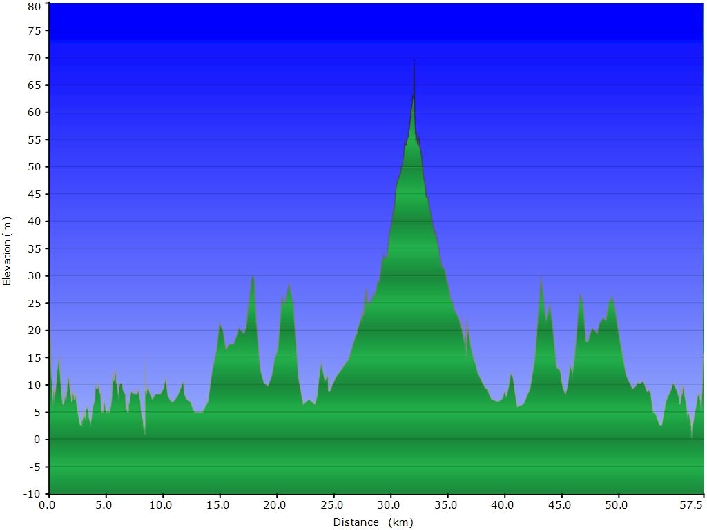
höhenprofil der fahrt von höfn zum hoffell viewpoint und zurück.
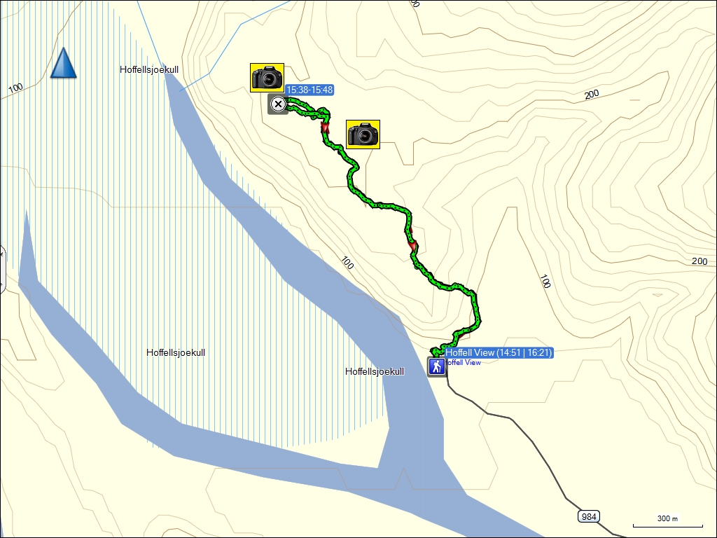
wanderung entlang des hoffellsjoekull (4.0 km).
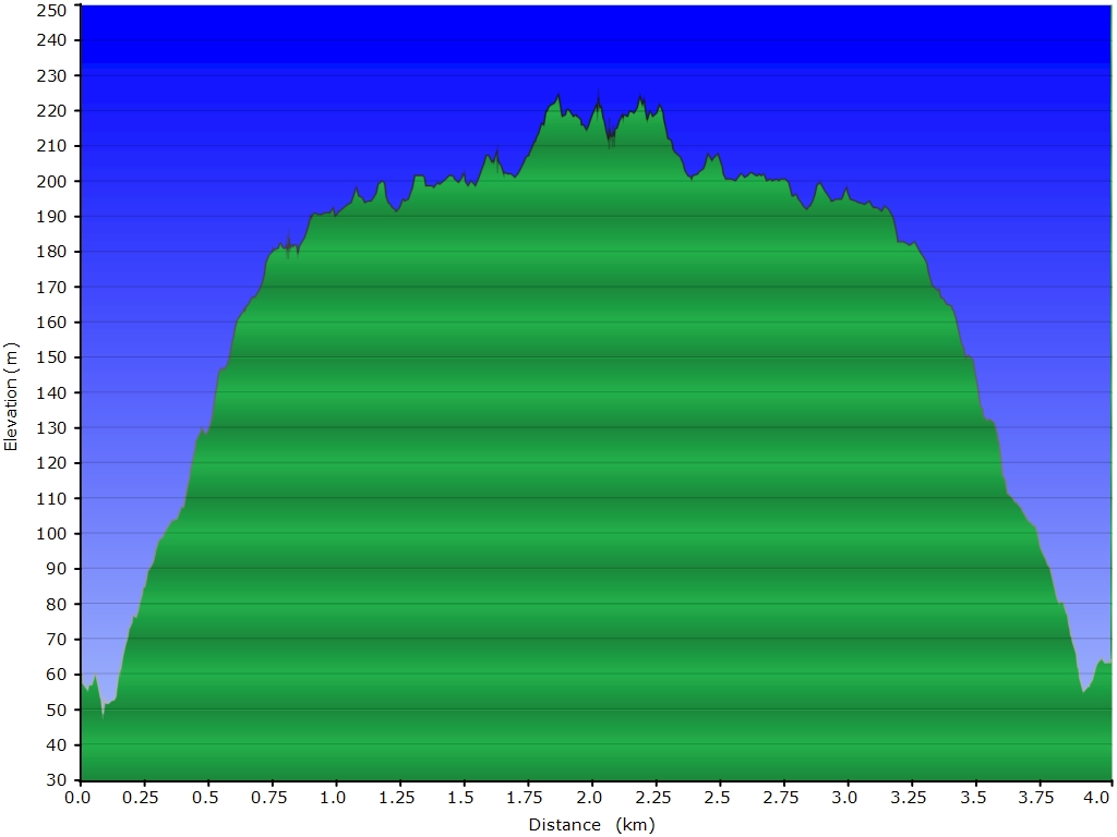
höhenprofil der wanderung entlang des hoffellsjoekull.
die GPS-empfänger wurden zur verfügung gestellt von TRAMsoft GmbH.
gestern | tagebuch | inhaltsverzeichnis | übersichtskarte | morgen
karte.html | 10-sep-2012 | the ambis